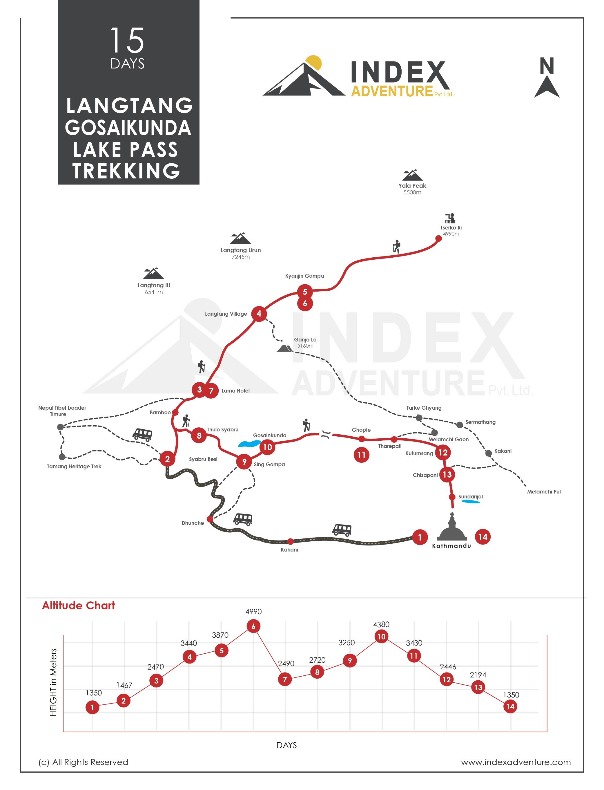
This Route Map and Altitude Chart are for Langtang Circuit Trekking (15 DAYS), also called LANTANG GOSAIKUNDA-LAKE PASS TREK. This fifteen-day trip involves walking for eleven days on a trail. Syabru Besi, the trailhead, is at an altitude of 1,467 metres. After taking all traversing to Tserko-Ri (4,990 metres), the highest point in the trek above Kyangin Gompa (3,870 metres), the route turns left towards Gosaikunda Lake from Bamboo, a small settlement, and reaches Gosaikunda-Lake Pass (4,380 metres). The return via a different route ends the walk-in Sundarijal, Kathmandu. This region also includes other popular treks, namely LANGTANG VALLEY TREKKING and TAMANG HERITAGE TREKKING.