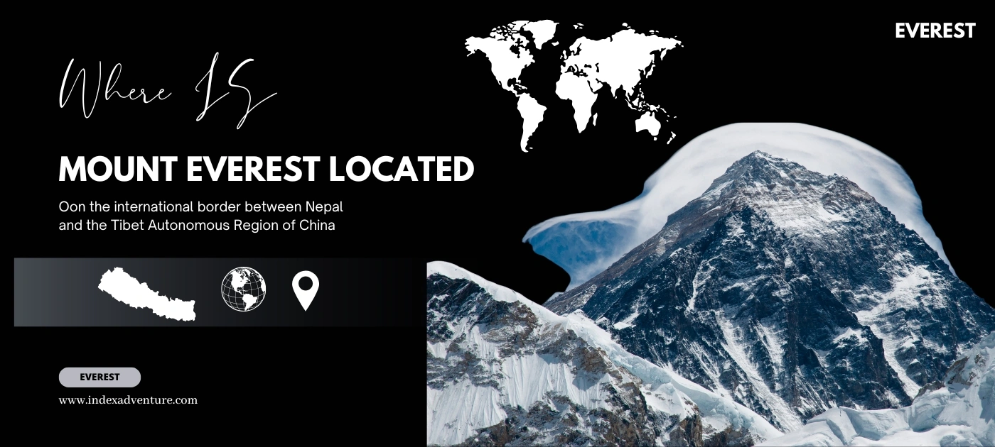
Where is Mount Everest located? This is one of the most popular queries among trekkers and climbers around the world. Mount Everest, the highest peak on Earth, lies on the border between two Asian countries: Nepal and Tibet (China). It sits in the Mahalangur Himal sub-range of the Himalayas, above the Qing Zang Gaoyuan, the Tibetan Plateau. If you are looking for the exact location of Mount Everest, the summit rises directly on the Nepal-China border.
On the Nepali side, Mount Everest lies in the Solukhumbu district inside a protected area called Sagarmatha National Park. On the Tibetan side, Mount Everest lies in Tingri County in the Xigaze area. Because the international boundary runs across the summit, the southern slope belongs to Nepal and the northern slope belongs to China.
Mount Everest Location at a Glance
- Nepal Side (South): Known as Sagarmatha, this side holds the southern slope and is reached through the Solukhumbu district.
- Tibet/China Side (North): Known as Chomolungma, this side lies in Tingri County.
- Coordinates: Approximately 27°59′18″N 86°55′31″E.
- Range: Part of the Mahalangur sub-range of the greater Himalayan range.
- Height:8,848.86 meters (29,031.7 feet) above sea level.
If you are thinking of climbing Everest or trekking to Everest Base Camp, most people go from the southern side. The side toward Nepal is more popular for climbing and Everest Base Camp trekking. Thousands of trekkers come to Nepal for Everest Base Camp trekking every season. Mount Everest is located on the border of Nepal and China (Tibet), with the summit lying directly on this border.
Where Is Mount Everest Located in the World?
Mount Everest is located in South Asia, on the border between Nepal and the Tibet Autonomous Region of China. It stands in the Mahalangur Himal section of the Himalayas, the great mountain chain that separates the Indian subcontinent from the Tibetan Plateau. Whether you search for where is mount everest, where is mt everest, or simply where is everest, the answer points to the same spot on the Nepal-Tibet frontier.
The mount everest location is fixed at roughly 27.9881° N and 86.9250° E. This places the peak in eastern Nepal on one side and in southern Tibet on the other. People who look up where is mount everest located in the world often expect a single country. The honest answer is that Everest sits on a shared boundary, which is part of what makes it so unusual.
Which Two Countries Share the Border of Mount Everest?
Nepal and China share the border of Mount Everest. The frontier runs straight across the summit, so the top of the mountain is the exact meeting point of the two nations. If you are asking which country shares mount everest border or which two countries share the border of mount everest, the pair is Nepal to the south and China (Tibet) to the north. No third country touches the peak.
Mount Everest is located on the international border between Nepal (in the south) and China (specifically the Tibet Autonomous Region in the north). The exact peak and the international boundary line run directly across the summit, meaning both countries share the mountain.
Where Is Mount Everest on the Map?
On a map, Mount Everest appears in eastern Nepal at the head of the Khumbu region, right where Nepal meets Tibet. The pin sits at 27.9881° N, 86.9250° E. Whether you look for mount everest on map, the mount everest location map, or a mt everest location world map, you will find it in the Mahalangur Himal, north of the town of Namche Bazaar.
Mount Everest is located directly on the international border line between Nepal and China (specifically the Tibet Autonomous Region). The exact peak, or summit, sits right on this boundary, meaning the mountain is shared by both countries.
Which Country Is Mount Everest In? Nepal, India, or China
Mount Everest does not belong to a single country. It sits on the border between Nepal and the Tibet Autonomous Region of China. The international boundary crosses the summit, which means the southern side belongs to Nepal and the northern side belongs to China. So when people ask mount everest in which country, what country is mount everest in, or mount everest located in which country, the correct answer names both Nepal and China.
Mount Everest is located directly on the border between Nepal (in the Solukhumbu District) and Tibet (the Tibet Autonomous Region of China). Because the international boundary line runs straight across the summit, the world's highest peak is shared by both countries.
Nepal is home to Mount Everest along with seven other peaks among the ten highest on the planet, which is why it is often called the country of the Himalayas. For anyone searching mount everest which country, mount everest country, or mt everest country, the peak remains the crown of the Nepali Himalaya and the shared boundary with Tibet.
Which Country Is Home to the Majority of Mount Everest?
Neither country holds a clear majority, because the border splits the mountain almost down the middle at the summit. In practice, the most visited and most climbed routes sit on the Nepali side. If you are wondering which country is home to the majority of mount everest, Nepal draws the larger share of trekkers and climbers, even though the rock and ice are divided between the two nations.
Is Mount Everest in Nepal? Where is Mount everest in Nepal Map?
Yes, Mount Everest is in Nepal. It is located in the Solukhumbu District of northeastern Nepal.
While the mountain's southern side is in Nepal, the summit sits directly on the international border, meaning the northern face is located in the Tibet Autonomous Region of China. Known as Sagarmatha in Nepal, it is the highest peak on Earth at an official elevation of 8,848.86 m (29,031.7 ft).
Yes, part of Mount Everest is in Nepal. The southern half of the peak lies inside Nepal's Solukhumbu district, within Sagarmatha National Park, a UNESCO World Heritage Site. When people say Mount Everest, Nepal, this is the side they mean: the face of the mountain most of the world pictures, and the side where the famous Everest Base Camp trek ends. So is mount everest in nepal gets a clear yes, with the caveat that the northern half sits in Tibet.
Is Mount Everest in India? Muntele Everest is not in India country
No, Mount Everest is not in India. The mountain sits entirely on the Nepal-China border, well outside Indian territory. The confusion is understandable, since the wider Himalayan range was formed by the Indian tectonic plate colliding with the Eurasian plate. The peak was also surveyed and named by the Survey of India in the 19th century, and it was called Mount Everest in 1865 to honor George Everest, the British Surveyor General of India.
Because of the width of Nepal, the summit is usually invisible from India. Under exceptionally clear conditions after major storms, though, Everest has been seen faintly from the plains of Bihar, roughly 175 km away. So while is mount everest in india is a common question, the plain fact is that it is not.
What Continent Is Mount Everest In?
Mount Everest is in Asia. It stands in the Himalayan mountain system of South Asia, on the Nepal-Tibet border. If you are checking what continent is mount everest in, the answer is Asia, the same continent that holds every one of the world's fourteen peaks above 8,000 meters.
What Mountain Range Is Mount Everest In?
Mount Everest is in the Himalayas, specifically the Mahalangur Himal sub-range in eastern Nepal. People often ask what mountain range is mount everest in or what mountain range is everest in, and the answer is the Himalaya, the great chain that runs across Asia. Everest is not in the Alps, and it is not in the Andes. The Alps sit in Europe and the Andes run through South America. Everest belongs to the Himalayan range alone.
Common Myths About Mount Everest's Location
A lot of search questions carry a wrong assumption baked in. Here are the most common ones, answered plainly, so there is no confusion about where Everest actually sits.
| Question |
Straight Answer |
| Is Mount Everest in the Alps? |
No. Everest is in the Himalayas in Asia. The Alps are in Europe. |
| Is Mount Everest in the Andes? |
No. The Andes run through South America. Everest is on the Nepal-Tibet border. |
| Does Mount Everest border Japan? |
No. Everest borders only Nepal and China (Tibet). |
| Does Mount Everest border Brazil? |
No. Brazil is in South America, thousands of kilometers away. |
| Is Mount Everest the world's longest river? |
No. Everest is the world's highest mountain, not a river. |
What Is Mount Everest Known for Worldwide?
Mount Everest is known worldwide as the highest mountain on Earth, standing 8,848.86 meters above sea level. It draws climbers chasing the ultimate summit and trekkers walking to its base, and it anchors the Sherpa homeland of the Khumbu. For anyone asking what is mount everest known for worldwide, the peak is famous for three things above all: its record height, its 1953 first ascent by Edmund Hillary and Tenzing Norgay, and the demanding climb through the Death Zone above 8,000 meters.
Standort des Mount Everest
Der Mount Everest liegt im Mahalangur-Himal-Massiv im Herzen des Himalayas. Er markiert genau die internationale Grenze zwischen Nepal im Süden und dem Autonomen Gebiet Tibet in China im Norden. Der Gipfel befindet sich bei den geografischen Koordinaten 27,9881° N und 86,9250° O und ist mit 8.848,86 Metern der höchste Berg der Erde.
Auf nepalesischer Seite liegt der Berg im Solukhumbu-Distrikt in der Koshi-Provinz und ist ein zentraler Bestandteil des Sagarmatha-Nationalparks. Der nördliche Teil befindet sich in Tingri County in der Präfektur Xigazê auf tibetischem Gebiet. Wer nach dem Standort des Mount Everest sucht, findet ihn also genau auf der Grenze zwischen Nepal und Tibet.
Unde Se Află Muntele Everest?
Muntele Everest se află pe granița dintre Nepal și Tibet (China), în lanțul muntos Himalaya. Vârful se ridică exact pe frontiera internațională, la coordonatele 27,9881° N și 86,9250° E. Pe partea nepaleză, muntele se găsește în districtul Solukhumbu, în Parcul Național Sagarmatha.
Cu o înălțime de 8.848,86 metri, Muntele Everest este cel mai înalt munte din lume. Se află pe continentul Asia, nu în Alpi și nici în Anzi. Dacă vă întrebați unde se află Muntele Everest sau în ce țară se află, răspunsul este clar: pe granița comună dintre Nepal și China.
エベレスト山の位置
エベレスト山は、ネパールとチベット(中国)の国境に位置し、ヒマラヤ山脈の中心にあります。山頂はちょうど国境線上にあり、座標は北緯27.9881度、東経86.9250度です。標高は8,848.86メートルで、世界一高い山として知られています。
ネパール側では、エベレストはソルクンブ郡のサガルマータ国立公園内にあります。チベット側では、シガツェ地区のティンリ県に位置しています。エベレスト山の位置を探している場合、答えはネパールとチベットの国境上ということになります。
Dove Si Trova il Monte Everest?
Il Monte Everest si trova sul confine tra Nepal e Tibet (Cina), nella catena montuosa dell'Himalaya. La vetta si trova esattamente sulla frontiera internazionale, alle coordinate 27,9881° N e 86,9250° E, ed è la montagna più alta del mondo con i suoi 8.848,86 metri. Sul versante nepalese, la montagna fa parte del Parco Nazionale di Sagarmatha nel distretto di Solukhumbu.
Ubicació del Mont Everest
El mont Everest es troba a la frontera entre el Nepal i el Tibet (Xina), a la serralada de l'Himàlaia. El cim s'alça exactament sobre la frontera internacional, a les coordenades 27,9881° N i 86,9250° E, i amb 8.848,86 metres és la muntanya més alta del món. Al vessant nepalès, la muntanya forma part del Parc Nacional de Sagarmatha, al districte de Solukhumbu.
O Monte Everest Localiza em Qual Cadeia de Montanhas | Localização do Monte Everest
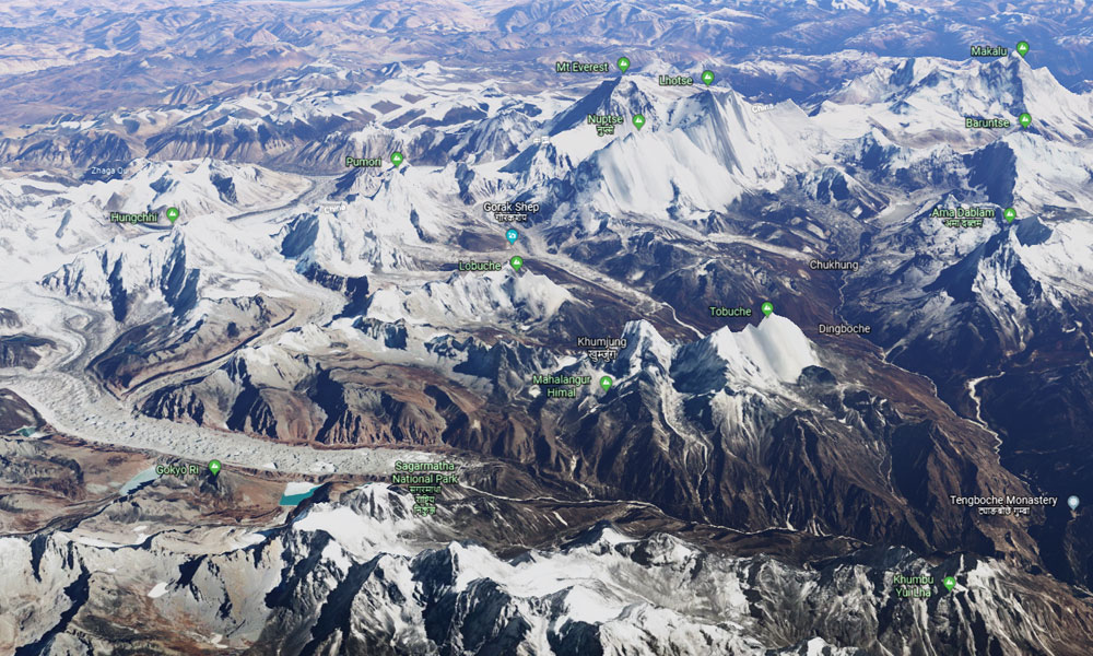
O Monte Everest está localizado na cordilheira do Himalaia, na Ásia. O pico exato fica na fronteira entre o Nepal e o Tibete (China), nas coordenadas 27,9881° N e 86,9250° O. Com 8.848,86 metros, é a montanha mais alta do mundo.
Se você quiser saber mais sobre a localização do Monte Everest, aqui estão alguns detalhes:
- No lado nepalês, a montanha fica no distrito de Solukhumbu, dentro do Parque Nacional de Sagarmatha.
- No lado tibetano, fica no Condado de Tingri, na região de Xigatse.
- O cume marca exatamente a fronteira entre os dois países.
Mount Everest and Its Names
Everest is a single peak with many names. In Nepal, people call it Sagarmatha. The word joins two parts: "Sagar," meaning the sky, and "Matha," meaning the forehead. Together they make Everest the "Forehead of the Sky." The best-known Tibetan name is Chomolungma, which means the Goddess Mother of Mountains. Another local name, Deodungha, means Holy Mountain in the Darjeeling area.
Mount Everest, the world's highest peak at 8,848.86 meters (29,032 feet), sits on the Nepal-China border. Known internationally as Everest, it is revered as Sagarmatha ("Goddess of the Sky") in Nepal and Chomolungma ("Goddess Mother of the World") in Tibet. The British named it Everest in 1865 to honor former Surveyor General George Everest.
Major Names of Mount Everest:
- Mount Everest (International): Named in 1865 by the Royal Geographical Society after Sir George Everest, a British Surveyor General of India. Ironically, George Everest objected to the choice and preferred local names.
- Sagarmatha (Nepali): Formally adopted by Nepal in the 1960s, this name translates to "Goddess of the Sky," "Forehead of the Sky," or "Peak of Heaven." Historian Baburam Acharya proposed it to honor the peak's Nepali identity.
- Chomolungma / Qomolangma (Tibetan/Chinese): This ancient Tibetan name means "Goddess Mother of the World." It has been used for centuries and is spelled Qomolangma in official Chinese sources.
- Peak XV (Historical): During the Great Trigonometric Survey of India, mathematician Radhanath Sikdar identified the mountain as "Peak XV" in 1852 and calculated that it was the highest in the world.
All of these names circulated before the mountain took its universal name. Everest got that name after the British Surveyor Sir George Everest.
How Tall Is Mount Everest? Height in Meters, Feet, and Km
Mount Everest is 8,848.86 meters (29,031.7 feet) tall, which makes it the highest mountain in the world. Nepal and China finalized this figure together in December 2020 after joint surveys that used GPS equipment and snow-depth measurements. So if you are asking how tall is mount everest, how high is mount everest, or what is the height of mount everest, the 2020 revision is the definitive answer.
| Measurement Type |
Official Height (2020 revision) |
| Meters |
8,848.86 m |
| Feet |
29,031.7 ft |
| Kilometers |
8.85 km |
| Above Sea Level |
8,848.86 m |
| Rock Height (no snow) |
8,844.43 m |
Geologists say Everest grows a little taller each year because of tectonic movement. For many years the widely accepted height was 8,848 meters, and the official figure until 1955 was 8,840 meters. The current number, agreed by both Nepal and China, stands at 8,848.86 meters.
Mount Everest Height in Km
The height of Mount Everest in kilometers is approximately 8.85 km (8.84886 km to be exact). This is the figure you want if you search for mount everest height in km, height of mount everest in km, or mount everest height in kilometers. Rounded, the peak stands just under nine kilometers above sea level.
Mount Everest Height in Feet
The height of Mount Everest in feet is 29,031.7 feet. Whether you look up mount everest height in feet or simply everest height in feet, the number comes from the same 2020 survey that fixed the metric height at 8,848.86 meters. That is the tallest any mountain rises above sea level anywhere on Earth.
Mount Everest Height Above Sea Level
Above sea level, Mount Everest reaches 8,848.86 meters. This is the standard way height is measured for mountains, from the average level of the sea up to the summit snow cap. Measured by rock alone, without the snow on top, the height is 8,844.43 meters.
How Do You Get to Mount Everest?
To get to Mount Everest, book a flight to Kathmandu, Nepal. Nepal is the main gateway to Everest, since most trekkers and tourists prefer the southern base camp on the Nepali side. It is generally easier to reach than the northern base camp in Tibet, and the trekking infrastructure is far more developed.
The Everest Base Camp trek is the most popular activity. EBC trekkers in Nepal usually fly from Kathmandu to Lukla airport, then walk the rest of the way to base camp. You can choose the package that fits you, including the Everest Base Camp trek 14 days, a short Everest Base Camp trek, or a luxury Everest Base Camp trek.
For a different experience, some walk the Everest Base Camp Trek via Jiri, the classic route used by Sir Edmund Hillary and Tenzing Norgay. Others take on the Everest Three Passes trek or the Everest Gokyo Lake trek. Trekkers heading to the Tibetan side reach the north base camp by road through Tingri County, but that route requires a permit from the Chinese government.
Trekking to Everest Base Camp in Nepal
.jpg)
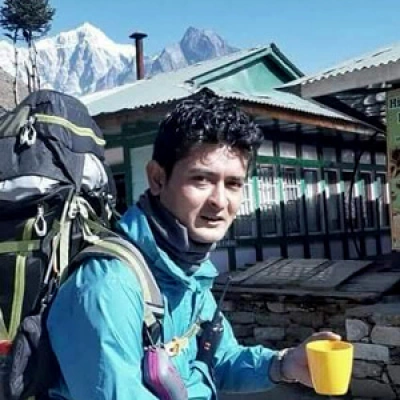
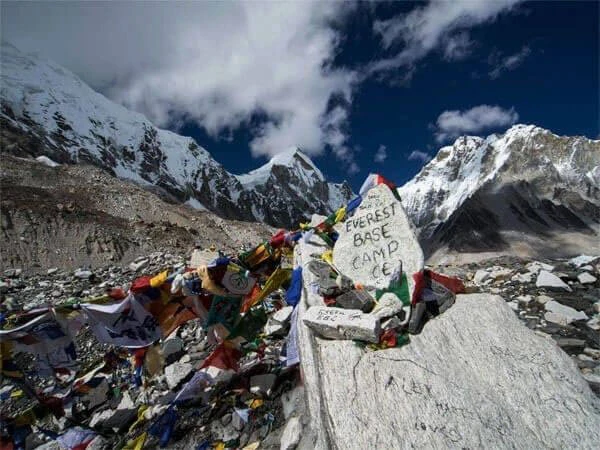
Climbing to the summit is not the only way to experience Mount Everest, Nepal's greatest attraction. You can trek to Everest Base Camp instead, the most popular trekking destination in the country. The trail takes you to the foot of the mountain through Sherpa villages, past Buddhist monasteries, and into the heart of Sagarmatha National Park.
Here is a detail most guides skip. You cannot actually see the summit of Everest from Base Camp itself, because closer peaks block the view. For the classic sunrise view of Everest, trekkers climb Kala Patthar, a rocky viewpoint at 5,644 meters above Gorak Shep. The pre-dawn climb is cold and steep, but the first light hitting the summit is the shot most people carry home. The Sherpa communities of the Khumbu run the teahouses along the way, and their knowledge of the terrain is a large part of why the trek is as safe as it is.
There are several routes that lead to base camp. Options include Mount Everest 3 High Pass Trekking, the Everest Base Camp trek, the Everest Base Camp Rapid Trek, the Cho La Pass Trek, and the Jiri to Everest Base Camp trek.
Climbing Mount Everest: Routes to the Summit
Because the summit of Everest sits directly between Nepal and Tibet, climbers can approach from both sides. Most prefer the southeast ridge in Nepal, since it is safer and better supported. Climbing Everest from the Tibetan side is more challenging, and the journey still begins at Everest Base Camp on whichever side you choose.
Climbing from the Tibetan north ridge is harder than from the Nepalese side. The routes are technically demanding, and rescue is more difficult because regional restrictions limit helicopter operations. For that reason, most climbers who aim for the summit start from Everest Base Camp at 5,380 meters and follow the southeast ridge, the route that offers the best margin of safety.
How Long Does It Take to Climb Mount Everest?
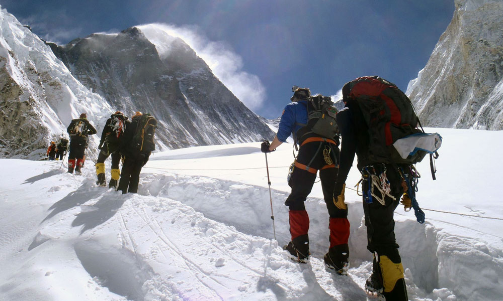
A full Everest expedition from the Nepali side takes around two months. That window covers the trek to base camp, the acclimatization rotations, the climb and descent, and the trek back to Kathmandu. The season usually begins in late March and ends in mid-May.
From the southern base camp at 5,380 meters, climbers move up through Camp 1, Camp 2, Camp 3, and Camp 4 before the summit push. Camp 1 (6,065 m) sits just above the Khumbu Icefall. Camp 2 (6,750 m) lies at the base of Lhotse. Camp 3 clings to the Lhotse wall on a small horizontal ledge, and Camp 4 is the last camp before the steep, snowy summit ridge.
The number of days needed is not the same for everyone. Weather, health, fitness, and acclimatization all change the timeline from one climber to the next.
History of Mount Everest: Who Climbed It First?
New Zealander Sir Edmund Hillary and Nepali-Indian Sherpa Tenzing Norgay were the first people to officially summit Mount Everest, on May 29, 1953. They reached the top at 11:30 a.m. local time via the Southeast Ridge, as part of a British expedition led by Lord John Hunt.
Everest has a long history of mystery. In 1924, British mountaineer George Mallory attempted the climb, and debate still surrounds whether he reached the summit before he died. His body was not found until 1999.
- The climbers: Hillary was a 33-year-old beekeeper, and Tenzing Norgay was a 39-year-old experienced Sherpa mountaineer.
- Previous attempts: Several British expeditions in the 1920s and 1930s failed, most famously Mallory and Andrew Irvine in 1924, who died on the mountain.
- The journey: The 1953 team used conventional open-circuit oxygen and took seven weeks to reach the summit.
- Significance: The 1953 ascent was the first confirmed climb after decades of failure, and it made the pair famous worldwide.
Deaths on Mount Everest: How Many People Have Died?
At least 344 people are known to have died on Mount Everest since records began in 1922. Roughly one climber dies on average each year, though the number varies. Even so, Everest is not the deadliest mountain in the world by percentage. More than 200 bodies are estimated to remain on the peak.
The zone above 8,000 meters is called the Death Zone, and it is where most fatalities occur. Deaths on Everest come from many causes, including avalanches, falls, exhaustion, exposure, frostbite, and altitude sickness. In 1996, a single storm killed several climbers in one of the mountain's most infamous disasters. On April 25, 2015, an earthquake triggered an avalanche that killed at least 19 people at base camp, the deadliest single day in Everest's history.
Key facts on Everest fatalities:
- Total deaths: At least 344 people are known to have died on the mountain.
- Most dangerous areas: The Khumbu Icefall (highest risk for Sherpas) and the Death Zone above 26,000 feet, which includes Camp 4 and the summit push.
- Causes: Avalanches, exhaustion, exposure, and altitude sickness lead the list.
- Unrecovered bodies: Extreme risk means many bodies remain frozen on the mountain, sometimes visible to passing climbers.
- Deadliest years: 2014 and 2015, due to avalanches and the earthquake.
"Where Is Mount Everest?" in 30 Different Languages
- English – Where is Mount Everest?
- German (Germany) – Wo liegt der Mount Everest?
- Malay (Malaysia) – Di manakah Gunung Everest?
- Korean (South Korea) – 에베레스트 산은 어디에 있나요?
- Hindi (India) – माउंट एवरेस्ट कहाँ है?
- Nepali (Nepal) – सगरमाथा कहाँ छ?
- Chinese, Mandarin (China) – 珠穆朗玛峰在哪里?
- Spanish (Spain/Latin America) – ¿Dónde está el Monte Everest?
- French (France) – Où se trouve le mont Everest ?
- Arabic (Middle East) – أين يقع جبل إيفرست؟
- Portuguese (Brazil/Portugal) – Onde fica o Monte Everest?
- Russian (Russia) – Где находится гора Эверест?
- Japanese (Japan) – エベレスト山はどこですか?
- Bengali (Bangladesh/India) – মাউন্ট এভারেস্ট কোথায় অবস্থিত?
- Urdu (Pakistan) – ماؤنٹ ایورسٹ کہاں ہے؟
- Turkish (Turkey) – Everest Dağı nerede?
- Vietnamese (Vietnam) – Núi Everest ở đâu?
- Indonesian (Indonesia) – Di mana Gunung Everest?
- Italian (Italy) – Dove si trova il Monte Everest?
- Thai (Thailand) – ภูเขาเอเวอเรสต์อยู่ที่ไหน?
- Swahili (East Africa) – Mlima Everest uko wapi?
- Dutch (Netherlands) – Waar ligt de Mount Everest?
- Greek (Greece) – Πού βρίσκεται το Όρος Έβερεστ;
- Polish (Poland) – Gdzie znajduje się Mount Everest?
- Persian / Farsi (Iran) – کوه اورست کجاست؟
- Tamil (India/Sri Lanka) – எவரெஸ்ட் மலை எங்கு உள்ளது?
- Telugu (India) – ఎవరెస్ట్ పర్వతం ఎక్కడ ఉంది?
- Punjabi (India/Pakistan) – ਮਾਊਂਟ ਏਵਰੇਸਟ ਕਿੱਥੇ ਹੈ?
- Ukrainian (Ukraine) – Де знаходиться гора Еверест?
- Romanian (Romania) – Unde se află Muntele Everest?
Can You Fly to Mount Everest?
You cannot fly to the summit of Everest, but you can fly to its base. Helicopter tours reach the southern base camp area through the Everest Base Camp Helicopter tour and the Mountain Flight to Everest.
These flights grow more popular every year, since they bring you close to the world's highest peak in a matter of hours rather than weeks. If you want to arrange a helicopter tour to Everest with us, let us know. We can set it up at any time of year. Contact Us.